In Our Spotlight
Going With the Flow
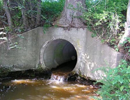
Many older culverts were made to move only water, not aquatic life.
There is a huge, hidden transportation system in New England, made up of critical highways and byways that exist alongside and rival our more familiar asphalt arteries, and that remain just as critical to the health and welfare of large communities.
Where the two transportation systems intersect, the result, too often, is a silent but disastrous pileup – disastrous, most immediately, for aquatic dwellers.
“Fish and other wildlife rely on the continuity and connectivity of rivers and streams just as we rely on continuity and connectivity in our roadways,” explains Scott Jackson, who directs UMass Extension’s Natural Resources & Environmental Conservation Program (NREC). “Wherever they meet, the waterway is in danger of being fragmented, and that can really harm the larger ecosystem.”
There are over 28,500 such road and rail crossings in Massachusetts alone, many incorporating older culverts designed simply for moving water. Decidedly low-tech, culverts are often hidden and largely, for many of us, forgotten as long as the traffic continues to roll.
“The design of a crossing, its size, shape, method of installation, and maintenance can have a huge impact on the movement of various species,” continued Jackson. “But if it is done well, the impact can be relatively small.”
That’s where UMass Extension’s River and Stream Continuity Project is making a difference. Advances in electronic mapping techniques, database management, and community monitoring, along with a new understanding of exactly of how a proper crossing should look, are coming together to create a huge regional inventory of crossings.
At the heart of the project is a process by which observers gather raw data regarding the size, shape, construction, and setting for any stream crossing. Coordinators then input the data into an online database where a scoring algorithm developed by Scott Jackson and his team attaches a numerical rating to each crossing, flagging the crossings most in need of an upgrade. A score of 0-1 means that a crossing is a severe barrier and is woefully inadequate; 9-10 means that almost any critter out there can breeze through.
That process has been quietly gathering steam since 2000, when it was launched in conjunction with the Massachusetts Watershed Initiative. Jackson has fine-tuned the algorithm and his team has worked to make the data gathering as accessible as possible. Extension’s partners in the project now include The Nature Conservancy and the Massachusetts Riverways Program.
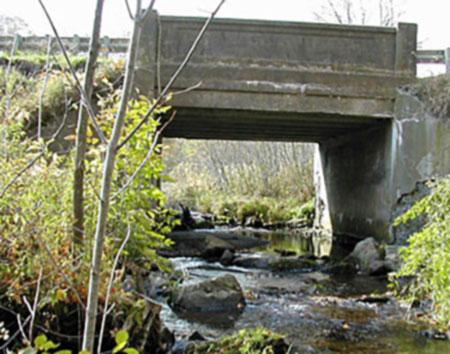
The best scores go to the designs that give safe passage to even the largest animals.
The project, however, is about to take a big step forward with the introduction of new database software tools, allowing a more user-friendly interface for the volunteers and coordinators who gather and provide data, improved verification and cross checking, and the potential to dramatically increase the number of sites inventoried. With the anticipated addition of the state of Maine to the mix, the River and Stream Continuity Project will cover all of New England, even as other states and federal agencies inquire about the system and how it might be applied to their states.
Critical to the expanded scope of the project have been two self-professed “techies,” neither of whom normally works with things like rivers and streams, but both of whom acknowledge a deep commitment to the ecological integrity that this project embodies.
“In some ways, it makes you want to run right out and start measuring culverts,” notes David Ruderman, a software engineer for UMass Amherst Outreach, who is working on the technical side of the project with Michael Muller, a consultant well-versed in the database management software called Cold Fusion. A big part of Ruderman’s job is to accommodate the small differences in each state’s approach.
“This is a simple relational database in many respects,” he said, “but there is the potential here for a much broader application, and the chance to make a difference to a critical area.”
Muller’s job is to make all that data easier to extract and interpret on the Web.
“This project is expanding, and as it does, there will be all kinds of new input. It’s important to make that additional input more user friendly, and to create a community of sorts,” he said. “With Cold Fusion, it’s good to have a consultant who can take a step back from the issue itself, and look carefully at access and usability.
The community component has been essential to the development of the project, says Jackson, especially since the on-the-ground observers are often volunteers from watershed associations, stream teams, and local chapters of Trout Unlimited, with coordination, training and technical assistance from the UMass Amherst Water Watch Partnership.
The data those observers provide, and the added accessibility and capabilities for parsing, will be important as the project focuses on its two other goals: promulgating standards for crossings, and helping to prioritize improvements. UMass Amherst’s ground-breaking computerized Comprehensive Assessment and Prioritization System (CAPS), which allows planners to develop maps that gauge the impact of a project on an ecosystem, takes setting priorities “to a whole new level,” says Jackson.
“For this kind of work, CAPS is a tool like no other,” said Jackson.
This story originally appeared in the Summer 2009 issue of In Common.

