University of Massachusetts Amherst Extension
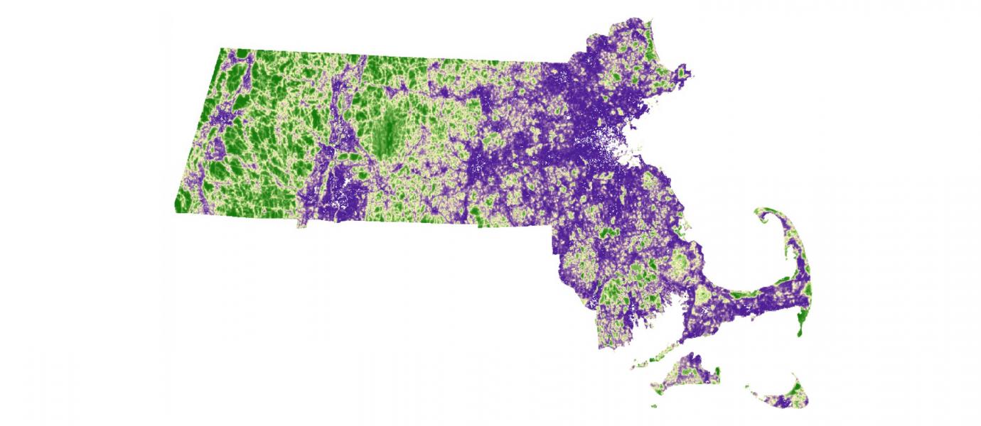
Calculates an Index of Ecological Integrity (IEI) based on human impacts and landscape characteristics, to highlight examples of ecosystems that are likely to maintain their natural composition, structure and function over time, in Massachusetts.
- Municipal maps available as high-resolution PDFs
- GeoTIFF file maps
- Online map viewers through MassEOEEA and Massachusetts Climate Action Tool
- GIS data can be downloaded.
The municipal maps are readily usable, the GeoTIFF files can be viewed in most image viewers and browsers, and the Massachusetts Climate Action Tool and Mass EOEEA viewers are simple to use. Access to, and familiarity with, GIS is required to explore downloaded data.
The Conservation Assessment & Prioritization System (CAPS) is an approach to prioritizing land for conservation based on the assessment of the ecological integrity for various natural communities (e.g. forests, headwater streams). Several metrics are applied to the landscape and then integrated in weighted linear combinations to create models for predicting ecological integrity. This process results in an Index of Ecological Integrity (IEI) for each point in the landscape based on models constructed separately for each ecological community.
CAPS takes a coarse filter approach by looking at ecosystems and ecosystem integrity, without focusing on individual species. There are several versions of MassCAPS outputs, all requiring GIS capabilities. CAPS is an assessment approach that yields data (e.g. IEI) that can be used for conservation planning, but is not itself a plan. Elements of CAPS analyses have been used in BioMap2, Designing Sustainable Landscapes (DSL) Nature’s Network, and Resilient & Connected Landscapes.
In addition to the Massachusetts CAPS assessment, UMass Amherst has produced a regional version of CAPS for the 13 northeast states as part of the Designing Sustainable Landscapes (DSL) project. MassCAPS is based on data only for Massachusetts, while DSL is based on data for 13 states, so the DSL version will be more correct near Massachusetts state borders and provides regional context—for instance regional IEI is scaled across all states in the region. MassCAPS is based on generally higher-quality data, including land cover, roofprints, traffic rates, soils, and the digital elevation model, while DSL uses data that are regionally-available, often of lower quality. MassCAPS also has several metrics not available in the DSL version: hydrologic alterations, nitrogen and phosphorus enrichment, salt marsh ditching, beach off road vehicles, beach pedestrians, coastal hardened structures, and boat traffic.
While MassCAPS does not explicitly focus on climate adaptation, areas with high IEI scores tend to be large, well-connected areas buffered from human activities, where natural processes are likely to remain intact over time. Within intact areas, natural systems are more likely to be resistant and resilient to impacts - from both humans and climate change. Areas of high IEI are likely to provide a diversity of niches and migration pathways important for maintaining biodiversity as climate change shifts species distributions over time.
Learn more about the terms used in this tool profile from the Glossary.